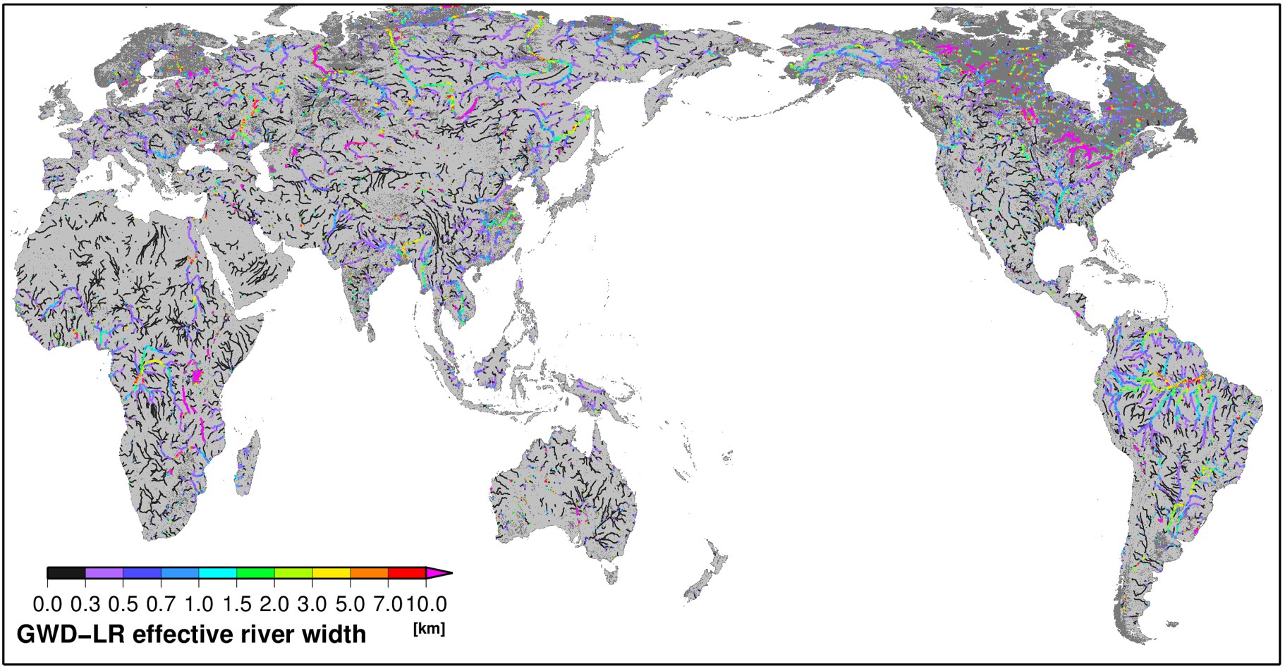
GWD-LR: Global Width Database for Large Rivers
GWD-LR (Global Width Database for Large Rivers) is a global river width dataset originally developed to support large-scale river hydrodynamic modeling.
⚠️ Notice
The official data distribution of GWD-LR has been discontinued.
The latest and improved global river width dataset is now distributed as part of MERIT Hydro.
👉 Please visit the MERIT Hydro page to access the current river width layer:
Overview
River width is a fundamental parameter in river hydrodynamic simulations.
GWD-LR was developed using an automated algorithm that derives river width from:
- Satellite-based water masks (SRTM Water Body Database)
- HydroSHEDS flow direction maps
The dataset provided:
- Bank-to-bank river width
- Effective river width (excluding islands)
The original resolution was 3 arc-seconds (~90 m), covering river channels between 60°S and 60°N.
Scientific Reference
If you refer to the GWD-LR concept or methodology, please cite:
Yamazaki, D., O’Loughlin, F., Trigg, M. A., Miller, Z. F., Pavelsky, T. M., & Bates, P. D. (2014)
Development of the Global Width Database for Large Rivers
Water Resources Research, 50, 3467–3480
https://doi.org/10.1002/2013WR014664
Contact
Dai YAMAZAKI
Institute of Industrial Sciences
The University of Tokyo
yamadai [at] iis.u-tokyo.ac.jp